Widgetized Section
Go to Admin » Appearance » Widgets » and move Gabfire Widget: Social into that MastheadOverlay zone
Vail, Beav’ blasted by 9 inches of snow with 2 feet more possible by Wednesday

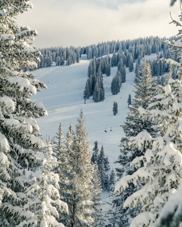
Following a 9-inch dump Sunday night into Monday morning, Vail is now spinning eight lifts, including the recently opened Chair 3, as yet another storm lines up to hit the Eagle River Valley with up to 2 feet of fresh snow Tuesday morning into Wednesday, which is opening day at Beaver Creek.
Vail on Monday morning was running 8 of 34 lifts serving 45 of 277 trails. Fantastic early season conditions continue to improve at Vail, with a settled base of 30 inches and 56 inches of snow so far this season.
“Beaver Creek Resort will open [Wednesday] with 300 acres of terrain, including Red Buffalo Park and Haymeadow Park, with Centennial Express Lift, Cinch Express Lift and Haymeadow Gondola spinning from 9:00 a.m. to 4:00 p.m.,” according to a Vail Resorts’ press release on Monday. “The resort will offer top-to-bottom skiing and riding for 3,340 vertical feet of continuous terrain, and 16 trails. Beaver Creek will offer dining options at Spruce Saddle, The Ranch, Ice Cream Parlor, Cookie Cabin and Citrea.”
Bobby Murphy, vice president and chief operating officer at Beaver Creek Resort, issued the following statement: “I am so excited to welcome guests back to Beaver Creek Resort. The fresh baked cookies, flawless corduroy and celebratory village atmosphere will make for a perfect Opening Day, and our team is just getting started for an incredible season ahead. I’d like to thank the entire Beaver Creek team for their efforts and on behalf of all of us, we’re excited to welcome you back to the resort for skiing and riding this season!”
Much more snow is on the way this week at both Beaver Creek and Vail.
“Monday’s weather will be dry, then a strong storm will bring snow from Monday night to Wednesday midday with 12-24 inches of accumulation at most mountains,” Opensnow.com meteorologist Joel Gratz wrote Monday morning. “The best powder should be on Tuesday afternoon and Wednesday morning/midday.”
For anyone considering backcountry skiing, the Colorado Avalanche Information Center (CAIC) issued the following press release warning of a significant increase in avalanche danger:
The Colorado Avalanche Information Center (CAIC) is warning backcountry travelers of a significant increase in avalanche danger across the Colorado mountains during Thanksgiving week. An atmospheric river is bringing heavy snowfall to Colorado this week, with up to three feet expected in some areas and at least two feet across much of the mountains.
“We’re particularly worried because we’ll see the most dangerous avalanche conditions we’ve seen so far this season when more people than usual will be getting out to recreate because of the holiday,” said CAIC Director Ethan Greene.
This rapid and heavy snowfall, combined with an already weak snowpack, will lead to dramatically different and significantly more dangerous avalanche conditions than seen so far this season. Avalanche danger is expected to reach HIGH (Level 4 of 5) in favored areas by Tuesday night, with large, dangerous avalanches possible.
“There will be an increased likelihood of natural and human-triggered avalanches that are large enough to seriously injure or kill a person this week,” said Greene.
CAIC issues avalanche danger ratings based on the North American Public Avalanche Danger Scale from LOW danger (Level 1) to EXTREME danger (Level 5). During certain avalanche conditions, CAIC also issues Avalanche Watches and Warnings when the avalanche hazard will be or is HIGH (Level 4) or EXTREME (Level 5). Special Avalanche Advisories are issued to alert the public of an increased safety risk due to potentially dangerous conditions for many people, such as a big storm occurring during a holiday weekend.
“The avalanche danger is going to be higher and avalanche conditions are going to be trickier this coming week than what we’ve seen so far this season,” said Greene. “There are still lots of great, safe places to go. We want people to check the avalanche forecast and make a plan that keeps them out of avalanche terrain or off of the dangerous slopes.”
Forecast Timeline:
- Tuesday: Avalanche danger will increase to HIGH (4 of 5) in the West Elk Mountains and CONSIDERABLE (3 of 5) in many other areas.
- Wednesday: Snowfall totals may reach three feet in areas like the Park Range, Flat Tops, and Elk Mountains, with two feet or more across most mountains Avalanche danger will likely reach HIGH (4 of 5) in much of the Northern and Central Mountains, and in the western San Juan mountains.
- Thanksgiving: Avalanche conditions are expected to remain very dangerous (CONSIDERABLE (3 of 5)
- Friday–Sunday: While the storm ends late Wednesday or early Thursday, dangerous avalanche conditions will continue as the snowpack adjusts to this rapid load. With clear skies, fresh snow, and the holiday weekend, backcountry activity will likely increase. Special Avalanche Advisories are anticipated.
This timeline is subject to change. For the latest avalanche conditions, always visit CAIC’s website at Colorado.gov/avalanche. The CAIC strongly advises all backcountry travelers to check the avalanche forecast regularly and adjust their plans accordingly. Always carry proper avalanche safety gear, including a transceiver, probe, and shovel, and know how to use them. Avoid avalanche-prone terrain during periods of heightened danger.


